Precision Navigation & Mapping™
Certified Data Solutions for Taxiing and En Route Navigation
Activate your systems with real-time, high-precision data for ultra safe in-flight or on-ground navigation. The Precision Navigation & MappingTM suite includes a worldwide Navigation database of dynamic digital airports, vertiports, terrain, imagery, and obstacle data. Allow Performance to rapidly develop your customizable navigation database for Flight Deck, Cabin Map, and Unmanned Traffic Management applications.
Customizable navigation and mapping solutions for…
- Advanced Air Mobility
- Unmanned Traffic Management
- Flight Decks
- Simulators
- Cabin Maps
- Maritime Freight Management

Advanced Air Mobility
Precise route definition and route replay simulation for VTOLs
Passenger confidence in poor flight conditions
“Safety-zones” created by data augmentation with sensory data
Safety assurance through our airworthiness validation expertise

Unmanned Traffic Management
Beyond visual line of sight, 3-D traffic corridor definition and control
Virtual infrastructure visualization for operators and air traffic control
Interoperability between autonomous vehicles and controlled airspace
Safely maximize occupancy of traffic corridors
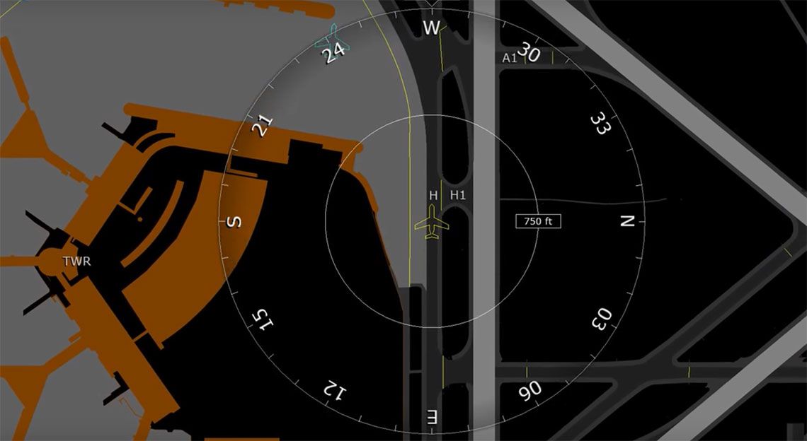
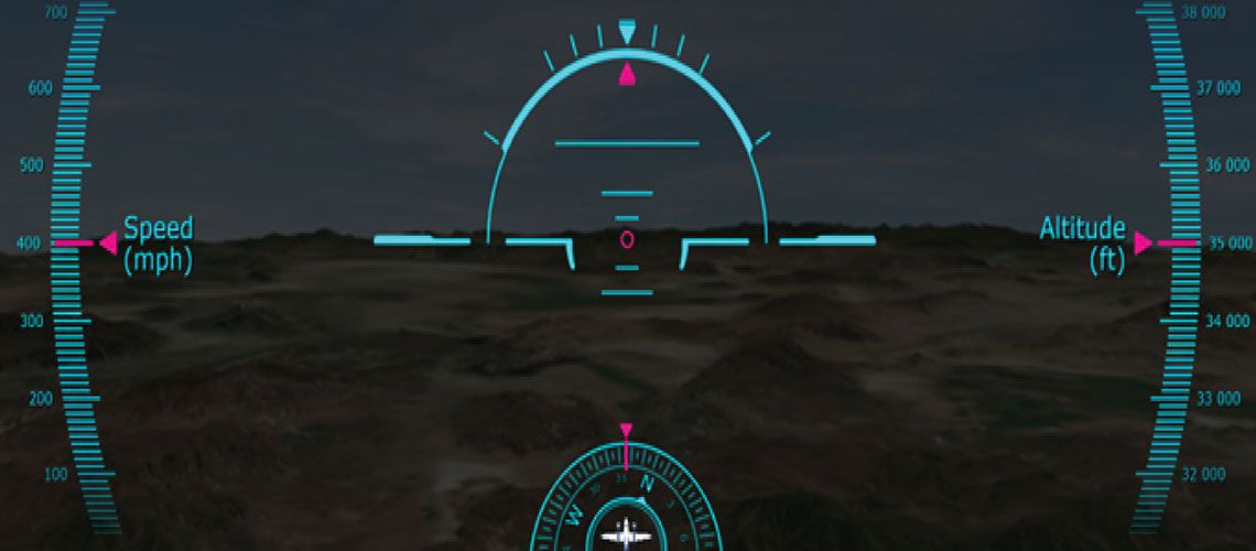
Flight Decks
Quantum leap in crew’s situational awareness
Auto-taxi ready for future navigation
Increased awareness, own-ship and surrounding environment (ADS-B)
FANS enabled, future traffic control to aircraft data link
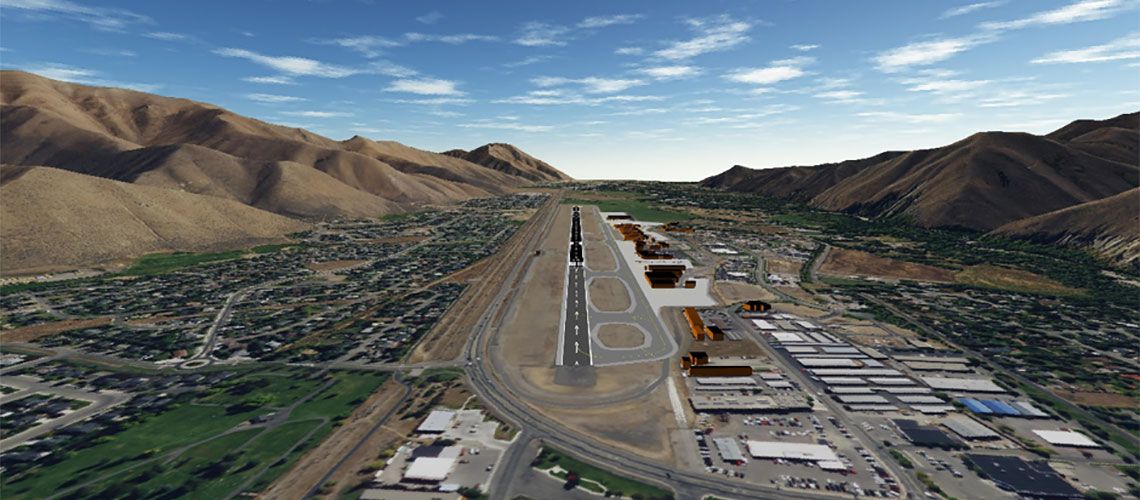
Simulators
Photo-realistic experiences, obstacles’ accurate relative position
Seamless and automatic rendering of 3D airports
Accelerates synthetic vision, eliminates manual process
Precise visualization, like looking out the window
Cabin Maps
Wow your VIP passengers with 3D mapping
Countless information to entertainment points of interest
Exciting landing experiences for passengers
“Glass Cabin” views, don’t miss a thing

Maritime Freight Management
Efficient Port Management for long-haul cargo
Safe navigation of recreational marinas
Enhanced visualization of ports and marinas at night or in bad weather
Increased awareness, display of own-ship and surrounding environment (AIS)
UNLEASHING SUB 1-METER PRECISION
5X MORE ACCURATE THAN OTHERS
Increase safety and reduce stress for passengers and crew
Use the best precision to answer where am I? How do I get where I’m going?
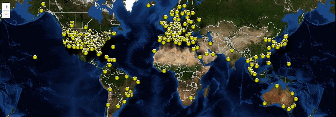
Worldwide airport database, continuously growing and frequently updated
Rapid customization of navigation solutions for your specific needs
Experience photo-realism at night or in poor weather conditions
FAA-ACCEPTED AIRPORT MAPPING SOLUTIONS
Performance provides high-quality, customizable solutions to seamlessly integrate into your mapping applications. We provide industry standard formats (ARINC 816, DO-200) and hold a Type 1 Letter of Acceptance. See all available features here.
Airport Mapping Database Catalog
Need a specific airport? Performance provides customized solutions with the best precision on the market.
Experience Precision Navigation
Contact us today for more information about Performance Precision Navigation & MappingTM solutions.
Available Features
- Aerodrome Reference Point
- Apron Element
- Arresting System Location
- ASRN Node
- Construction Area
- Final Approach And Take Off Area
- Helipad Threshold
- Land And Hold Short Operation Location
- Parking Stand Area
- Road
- Runway Displaced Area
- Runway Exitline
- Runway Marking
- Runway Threshold
- Stand Guidance Line
- Survey Control Point
- Taxiway Guidance Line
- Taxiway Intersection Marking
- Touchdown Lift Off Area
- Vertical Point Structure
- Water
- Aerodrome Surface Lighting
- Arresting Gear Location
- ASRN Edge
- Blastpad
- Deicing Area
- Frequency Area
- Hotspot
- Painted Centerline
- Parking Stand Location
- Runway Centerline Point
- Runway Element
- Runway Shoulder
- Service Road
- Stopway
- Taxiway Element
- Taxiway Holding Position
- Taxiway Shoulder
- Vertical Line Structure
- Vertical Polygonal Structure
